
Downham Road - Proposed road safety and public realm improvement scheme
Results updated 7 Mar 2025
Thank you to everyone who responded to this consultation.
The delegated powers decision report showing the results of the consultation is available to download below.
Files:
- Signed DPD Report - Downham Road, 6.3 MB (PDF document)
Overview
Help us improve Downham Road
Following two drop-in events with local people, we are proposing to improve a section of Downham Road between the junctions of De Beauvoir Road and Kingsland Road (A10). This includes widening pavements, creating chicanes to reduce vehicle speeds and adding new trees, rain gardens and more greenery. This will help create a safer and more pleasant walking environment along the street. We are now seeking your views on these proposals.
Why are these changes being proposed?
The proposals form part of our plans to create a greener, healthier Hackney. They will help improve road safety and support people to walk, shop and cycle locally.
Road safety data shows that between November 2019 and October 2022 a total of five collisions which resulted in personal injuries were recorded by the police on Downham Road between De Beauvoir Road and Kingsland Road (A10). There were five casualties, of which one was a serious injury and four slight injuries. Records indicate two of the casualties were pedestrians, one was a cyclist, with the remaining three being vehicle drivers and passengers.
Traffic surveys completed during July 2021 showed that 7827 vehicles per day used Downham Road (both directions) with the mean speed being 19.6 mph.
The Council has also been approached by local people who have concerns about road safety along Downham Road. They would like to see a wider pavement outside the school, crossing facilities for school children, measures to prevent the u-turning of vehicles in front of the school and speed reduction along Downham Road. Some people have also expressed support for the introduction of segregated cycle lanes along Downham Road.
What are the proposals?
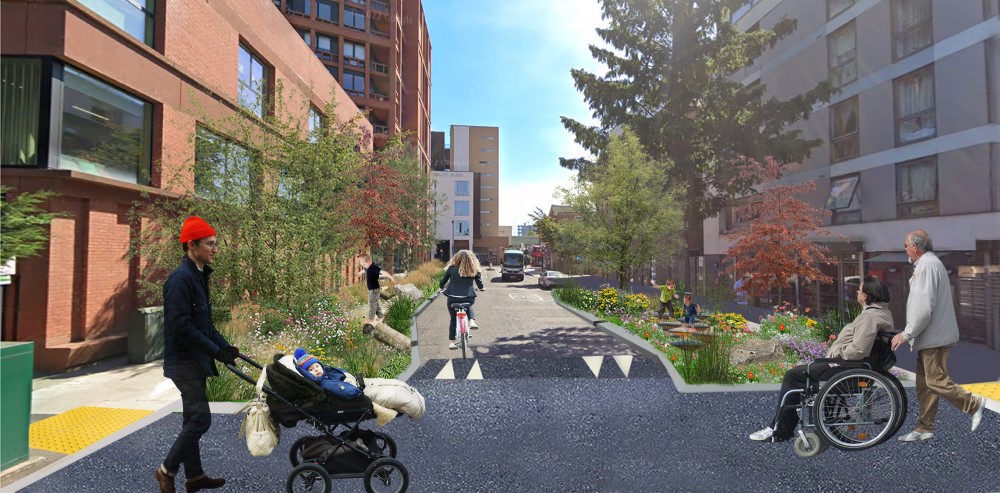
The following measures form the core of the proposed scheme to create a safer environment for all road users, especially vulnerable pedestrians who require further assistance to cross the road. These are illustrated on the drawing and include:
- Wider pavements
- Kerb build-outs with chicanes and a speed table across Downham Road with a step-free crossing
- Urban greening (planting trees and shrubs) and rain gardens along the road. This would change the look and feel of the environment, influence driver behaviour, support biodiversity and reduce flooding risk.
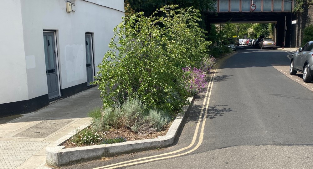
Example of a rain garden
- A central island rain garden and urban greening at De Beauvoir Road junction
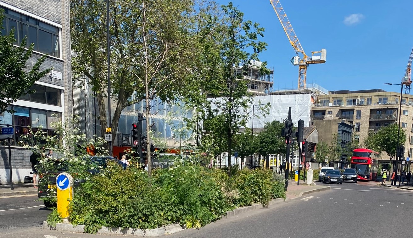
Example of a central island rain garden
- Reducing the crossing distance at the junction of Hertford Road (kerb build-outs)
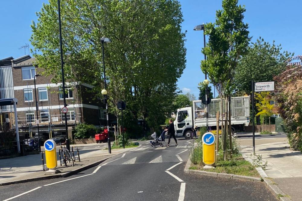
Example of a kerb buildout with speed table and zebra crossing
- A central island rain garden and urban greening at Kingsland Road junction
- A junction table at Hertford Road with a step-free zebra crossing by converting the existing pedestrian refuge on Downham Road
- Removing 70m of parking bays within the proximity of the Hackney New Primary School entrance, to reduce the width of the carriageway (kerb build-out), including a rain garden, urban greening, a play area and seating. The addition of a‘play on the way’ element will have a positive impact on creating a safer and more child-friendly environment, aligning with the Mayor of London’s Making London Child-Friendly report and Hackney’s Child-Friendly Places Supplementary Planning Document (SPD).
- Removing the existing left turning lane at the junction of Kingsland Road junction and providing a rain garden, urban greening, subject to funding and Transport for London (TfL) approval
- Removing 10m of parking bays at the Mortimer Road junction, providing kerb build-outs together with a rain garden, urban greening and a speed table across Downham Road with a step-free crossing facility
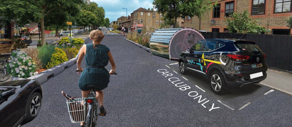
- Reallocating 24.5m of parking bays on Downham Road to create a rapid EV charger and provide cycle hangars and a car club bay
- Reallocating 10m of parking bays on Hertford Road to create cycle parking facilities and a dockless cycle bay.
Public engagement
In developing the proposals, the Council hosted two drop-in events at the Rose Lipman Hall with local residents to obtain feedback on current road safety concerns and two possible new designs for the road.
101 people filled out surveys at the workshops, which asked about two options for the road:
Option 1 - Road safety and public realm improvements without segregated cycle lanes:
This design incorporated wider pavements whilst maintaining two general traffic lanes. The aim is to prioritise pedestrians and improve road safety. The scheme would introduce a chicane, raised speed table and crossing facilities on the road. This would reduce vehicle speeds and improve crossing facilities close to the school. This design would incorporate urban greening to improve the public realm, to create a more pleasant look and feel of the local environment. To accommodate this scheme, approximately 12 car parking spaces would have to be removed.
Option 2 - Road safety and public realm improvements with segregated cycle lanes:
This design would maintain two general traffic lanes and include cycle lanes in each direction. The aim of this option is to create a safer cycling environment, whilst providing speed reduction measures with pedestrian crossing facilities. However, this option would provide less green space in order to include the cycle lanes. To accommodate this scheme, all 44 car parking spaces would have to be removed.
An independent consultant (Steer Group) was appointed to analyse the engagement feedback. The majority of people who attended the engagement events were in favour of Option 1.
Technical assessment
Steer Group was also appointed to analyse the proposed design options from a technical point of view through a multi criteria assessment (MCA).
The MCA was used to identify the benefits and constraints of each design option, in a structured and comprehensive format. The criteria for the MCA were identified to ensure that both options were robustly assessed in a holistic manner, considering a wide range of direct and indirect impacts.
The preferred option had to strike a balance between achieving the Council’s objectives of encouraging more walking and cycling, while considering the impacts on resident access, car parking, road safety and general traffic conditions. The MCA highlights how each option influences that balance, to provide a clear, exhaustive, and evidence-based summary of the considerations. The MCA helped guide the decision making process on what option to take forward to further develop into a road safety and public realm improvement scheme.
Full details of the MCA summary note and MCA assessment can be found here and here.
Following the assessment and the feedback from local residents, we have decided to proceed with consultation on Option 1. As well as addressing the concerns, Option 1 also maintains further kerbside space for any future policy initiatives (e.g. electric vehicle charging EV bays, cargo bike bays and
parklets).
What happens next?
Your views will be taken into account as part of the detailed design process. We will publish the consultation results as well as the decisions made at consultation.hackney.gov.uk
Permanent works
If the scheme goes ahead, following consultation, we expect construction works to start in Summer 2024, with completion in about six weeks. Further information regarding the works will be sent out closer to the time.
Information
For further information on these proposals, please contact the Hackney Service Centre by calling 020 8356 2897 or by emailing streetscene.consultations@hackney.gov.uk
Accessibility statement
If you need any information on this consultation in a different format please email consultation@hackney.gov.uk.
We’ll consider your request and get back to you in five working days.
Interests
- Understanding views
Share
Share on Twitter Share on Facebook